Below you can view a list of frequently asked questions. If you have a question that is not covered below be sure to get in touch on 061- 708423 or request a call-back on the Support section of the website. A member of our team would be happy to direct you through any queries you might have.
As you measure each paddock the results will pop up on your screen in real-time. These include compressed sward height (CSH)(mm), average CSH(mm), cover (kg/DM/ha), cover within the paddock, growth rate since last measurement (kg/day/ha). At the end of the walk you have the option to look at the results, including the grass wedge, total farm cover and average farm cover in the wedge tab at the bottom of the home screen.
You can view your paddock results by selecting ‘Paddocks’ from the home screen. This feature is unavailable while the Grasshopper is in use on a grass walk.
Yes, a farm map is required. This can be generated on the farm using Grasshopper. Each paddock needs to be geo-coded so that Grasshopper knows where it is during subsequent surveys.
The Grasshopper app is designed to work without data network coverage. It does not rely on any external network for mapping. However, it does require a network connection to upload data to an external database such as PastureBase or AgriNet.
Paddocks are mapped by selecting the mapping option in the Grasshopper app and walking the perimeter of each paddock. You have the opportunity to add, rename or delete paddocks from the main menu later.
Covers are uploaded once the walk is finished and you select ‘upload data’ from the app's home screen. The results will arrive into PastureBase or AgriNet within seconds. If network data or WiFi is not available at the time of upload, results will upload in the background as soon as data connection allows.
Each user can manage up to five farms through the app.
An unlimited number of paddocks may be added to each grazing block/farm profile.
The farm profile contains all paddock maps and your settings. The farm profile is named by the farmer when they are setting up the farm. You can rename this at any time in the settings menu.
No. The app is free to use and always will be.
Yes. Just check the PastureBase Ireland box in setup. Do not pre-load paddocks in PBI, these will go in when you upload your first walk. A PBI account must first be set up with PastureBase directly on 046 920 0965.
No. Most available farm maps are not in standard GIS formats. Grasshopper relies on its internal GPS to map and later find paddocks during the grass-walk.
If you are logged in, your farm ID can be found on the home screen of the app. If you have forgotten your ID, please get in touch with our support team either by phone or through the ‘support’ tab on our website.
Your grass wedge can be accessed on the Grasshopper app and on GrasslandTools/PastureBase Ireland/AgriNet, depending on which of these options you have selected in the app.
Yes. Allocation mode can be selected from the paddock menu or the farm map on the home page.
Grasshopper takes a series of samples across the paddock being surveyed. Each sample is tagged with a date, time (to the second) and it's geo-location. The sample is the compressed height of the grass at the sample point. When reviewing sample data it is possible to review any single sample, a small area, or the paddock as a whole via the .csv file.
Yes. Each block is considered a grazing platform in its own right. Contact PastureBase or AgriNet to determine how you should treat different grazing platforms if you are using the same herd number or code.
Yes. As many users as the farmer would like can sync the farm on their own phone by using the unique farm ID. Any phone can be synced on the farm automatically.
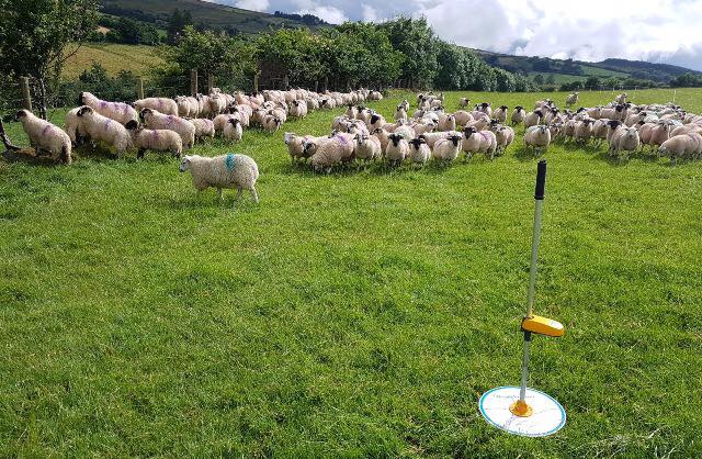
Grasshopper has up to 6 hrs battery life. Grasshopper has a smart charger meaning you can’t do any damage by leaving it plugged in when not in use.
Your Grasshopper ID can be found on the product label on the underside of the sensor unit, or on your warranty card.
Green flash – GPS acquired, ready for use.
Red – unit waiting for GPS or calibration on older models.
Blue – unit is charging. Goes out when fully charged.
Yes. Grasshopper may be used worldwide.
Yes. Using the allocation option in 'area' mode you can accurately re-organise your paddock layouts.
Yes. Using the unique farm ID any phone can be synced on the farm automatically.
Yes. To use the Grasshopper app, your tablet should have Bluetooth and Wi-Fi as a minimum.
Walk result files are very compact. A grass walk of thirty paddocks takes typically 250kb - or less than one-third of a normal picture.
If you are having problems with the app, first ensure you have the latest version downloaded from the App Store (iPhone) or Play Store (Android). If the issue persists after updating the app, please get in touch either by phone or through the support channel on the website.
Any Apple or Android smartphone purchased within the last 5 years should be sufficient. For older models, results may vary. If you are unsure whether your phone is compatible, please get in touch with our support team.
For iPhone users: you can find the Grasshopper app on the iOS App Store by searching for 'Grasshopper – made to measure'. For Android users (Samsung, Xiomi, Google, OnePlus, Motorola etc): You can find the app on the Play Store by searching for 'Grasshopper – measure to manage'.
Yes. To purchase your farm whiteboard, please contact the us via phone or through our support channel to arrange printing and delivery.
Your grass wedge can be accessed on the Grasshopper app and on GrasslandTools/PastureBase Ireland/AgriNet, depending on which of these options you have selected in the app.
The live dry matter measure is a function of the amount of grass, the moisture content at the time of measure, and the time of year, or more correctly the stage in the season. The current dry matter percentage can be found on the PastureBase Ireland website.
We recommend 40 to 45 depending on conditions and no less than 35. If the grass varies in height across the paddock, more drops should be taken. Be sure to include all areas of the paddock in order to get a representative value.
Geotagging is the attachment of latitude and longitude information to the sample. This information is unique to every sample and will have an accuracy of 1 to 1.5m depending on location and the GPS constellation at the time the sample was taken. Geotagging allows data analysis based on defined areas.
Yes. Allocation mode can be selected from the paddock menu or the farm map on the home page.
Residency time is the time the herd spends in the paddock between milkings. In the case of a beef herd or sheep flock, it is the time they spend in the paddock before moving on to the next one. It is measured in hours.
Livestock demand is determined largely by enterprise, breed, livestock weight, age and yield. Multiply the daily intake by the number in the herd/flock and you have a 24hr demand figure. Strip fencing and allocations can be done between milkings or on bigger paddocks as needed.
No, but it is necessary you complete it on the same day if you are using PastureBase Ireland to produce a single wedge for the walk.
No, you can map the farm at your own pace. The important thing is to take your time and do it well.
Not unless you are registered for VAT, as it is not a fixed asset.
How to apply for a Grasshopper Plate Meter on the TAMS II Grant
True North Technologies is located in Shannon, Ireland and provides leading-edge decision-support tools for the Agricultural sector.
COPYRIGHT © TRUE NORTH TECHNOLOGIES LIMITED 2021-2024